





















News
European technologies in security and space
Commissioner Andrius Kubilius' visit to CloudFerro highlights the importance of European technologies for Europe's security and operational readiness

News
Commissioner Andrius Kubilius' visit to CloudFerro highlights the importance of European technologies for Europe's security and operational readiness
News
CloudFerro introduces Search Agents & Knowledgebases to Sherlock, making it easier to build AI assistants that answer questions based on an organization's own documents.

The view from space offers an expanded perspective on Earth. It is remarkable how data can be obtained and comprehended through satellite-based Earth observation.

Copernicus Data Space Ecosystem is taking Copernicus programme to the next level, where its data will make the greatest possible impact on users, all citizens and, ultimately, on our planet. Read about the new ecosystem and the benefits it will provide to our users.
The development of technology and the integration of satellite data with environmental models have given us the ability to observe the Earth on a large scale. One of the tools used to monitor the state of the environment, especially complex ecosystems such as forests, is satellite remote sensing.

Join the 7th edition of the “Seize the beauty of our Planet” contest for the best EO image. This year’s theme: “Untouched Wilderness – The Raw Power of Nature”

CloudFerro has received the Economic Award of the Polish Ambassador to Germany for the best Polish company operating in Germany.
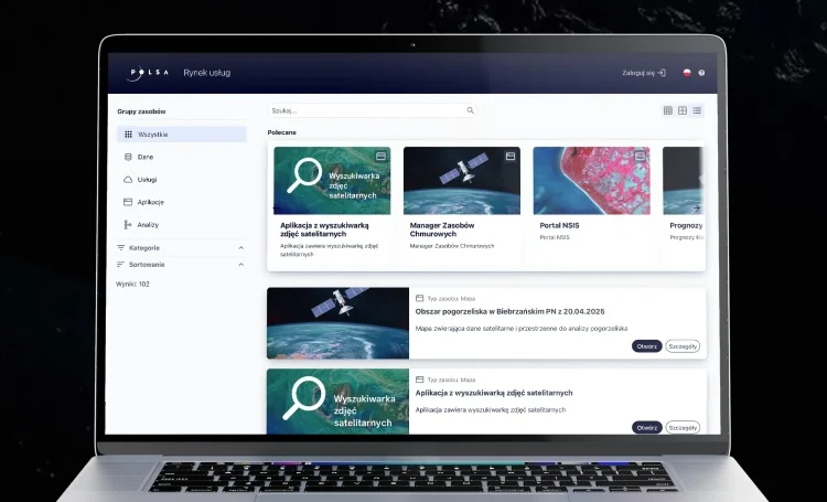
NSIS Cloud - a new cloud computing service for the Polish public administration and researchers - has been launched. The service, delivered by CloudFerro and GIS Partner, combines a satellite data repository for Poland with a scalable cloud computing environment, creating the foundation of Poland’s satellite data processing system.
EO Products & Services
Process EO data at scale close to where it is stored, using flexible cloud compute resources.
EO Products & Services
Transfer large EO datasets quickly and securely between CloudFerro EOData and your own infrastructure via scalable S3 access.
EO Products & Services
Access and manage large-scale EO datasets from multiple satellite missions through a unified, scalable repository built for analytics, AI, and operational workflows.
Accelerate AI model development on EO data with ready-to-use embeddings, training datasets, and in-place processing.