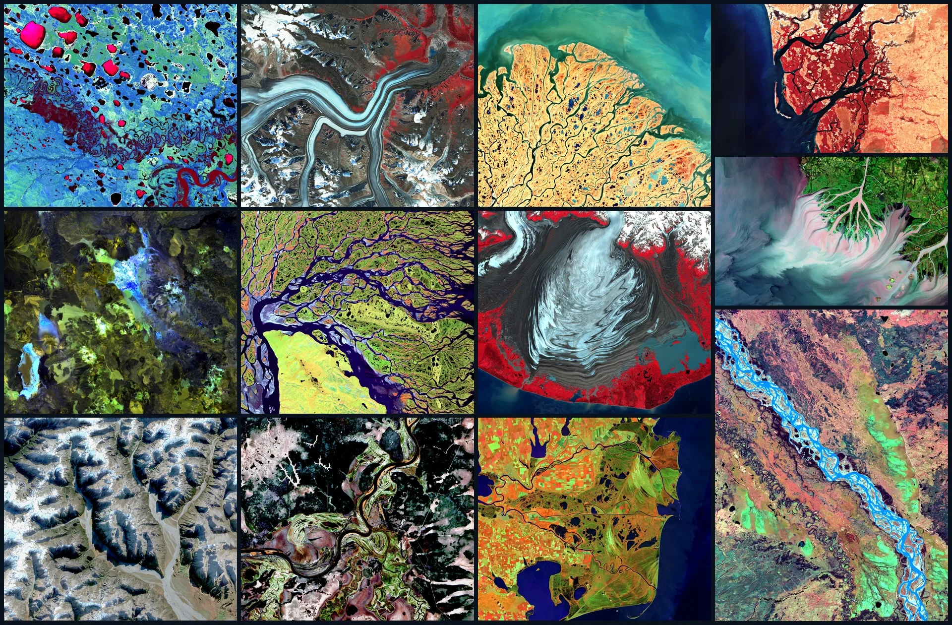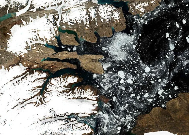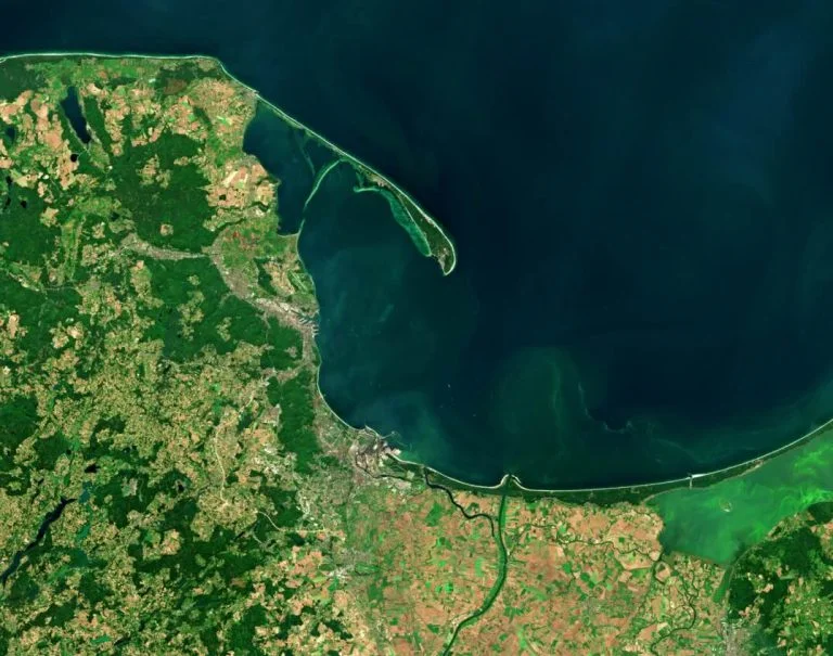

























From the Arctic waterways to a growing river delta in Louisiana and the volcanic highlands of Chile, the winning images of ‘Seize the beauty of our Planet’ 2026 reveal extraordinary natural landscapes.
Satellite images capturing an Arctic river delta, a growing coastline in the Gulf of Mexico, and the volcanic highlands of the Andes have taken the top three places in the 7th edition of the international “Seize the beauty of our Planet” contest.
Held under the theme “Untouched Wilderness – The Raw Power of Nature”, the competition showcases how data from the European Copernicus programme can reveal natural processes invisible from the ground. Following a public vote, 12 images advanced to the final stage, where an international jury of Earth observation experts selected the three top winners. This year's jury included representatives of the European Space Agency (ESA), the European Organisation for the Exploitation of Meteorological Satellites (EUMETSAT), the Polish Space Agency (POLSA), the European Association of Remote Sensing Companies (EARSC), the Polish Institute of Geodesy and Cartography (IGiK), and CloudFerro.
This year’s top winners — a geospatial data scientist, an English literature graduate, and a geography enthusiast — reflect the broadening reach of Earth observation tools across both scientific and non-technical communities.
While the winning images celebrate the artistic side of remote sensing, they also reflect a broader shift toward cloud-based processing and AI-driven analytics that make Copernicus data easier to use at scale.
First place: A river becomes a work of art
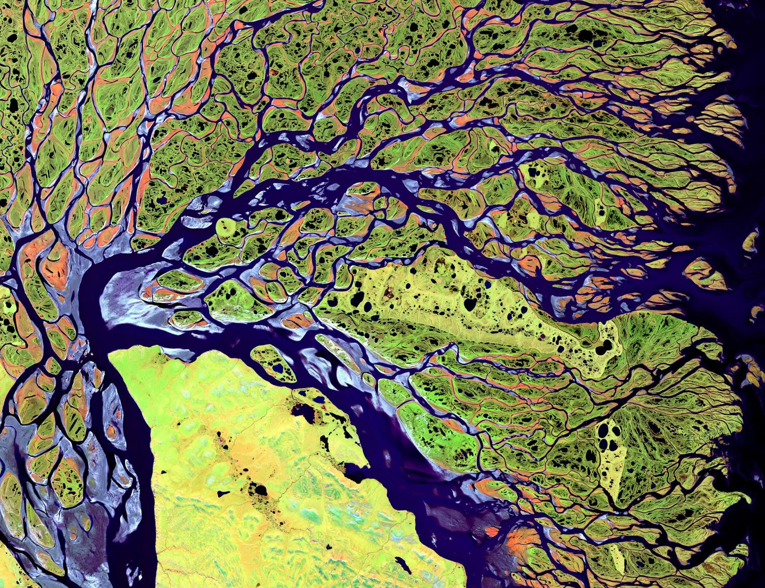
Abran Idrees, a geospatial data scientist from Portugal, won first place with “A Thousand Paths to the Arctic”, showing the Lena River Delta in northeastern Siberia. In his Sentinel-2 image, dark violet waterways wind between green wetlands and orange-toned islands. Thousands of interconnected channels form an extraordinary natural mosaic, created by the movement of water and sediment over time.
The Lena Delta is one of the most remarkable river systems in the Arctic. Its constantly changing landscape reveals processes that are difficult to appreciate from the ground but become strikingly visible from space.
I chose the Lena River Delta in Siberia because of its extraordinary natural patterns, intricate waterways and vibrant colours. My aim was to showcase how Earth observation combines scientific discovery with the artistic beauty of nature.
- Abran Idrees, Geospatial Data Scientist, Portugal (1st place)
Abran Idrees holds an Erasmus Mundus master's degree in Geospatial Technologies. His professional interests include satellite remote sensing, geospatial artificial intelligence and environmental monitoring.
Second place: Discovering Earth observation through an unexpected path
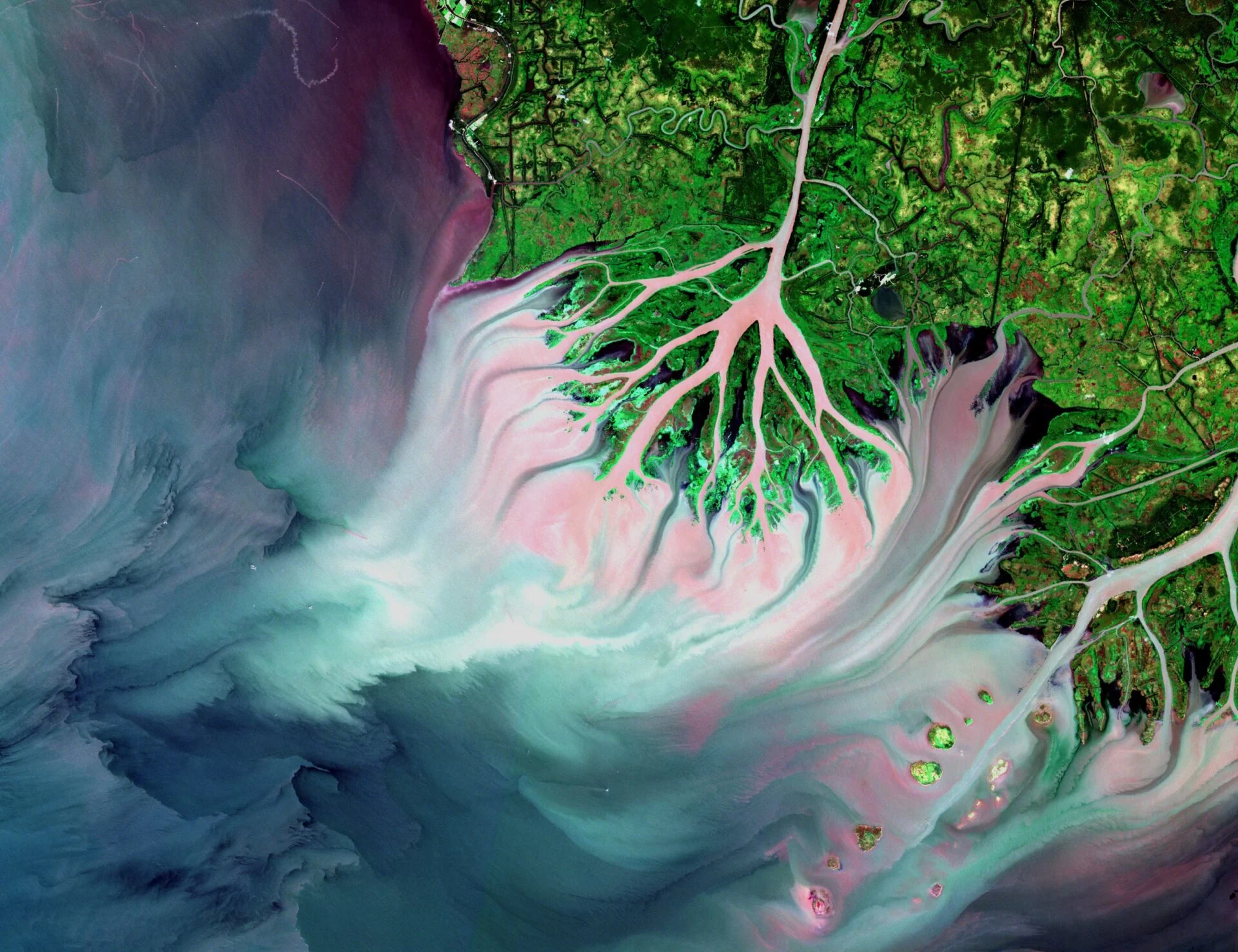
Second place went to Qurat ul Ain Fatima from Pakistan for “The Birth of a Delta”, depicting the Atchafalaya Delta in Louisiana, USA.
Qurat ul Ain Fatima, a graduate in English Language and Literature from Government College University Faisalabad, prepared an image which shows a remarkable landscape where a river is continuously creating new land. Sediment carried towards the Gulf of Mexico gradually settles to form islands and wetlands, while other parts of Louisiana's coastline are experiencing erosion and land loss.
The striking patterns of water, land and vegetation caught the author's attention. But her interest in satellite imagery began far from the world of remote sensing.
I come from a humanities background, and my interest in satellite imagery started unexpectedly when I attended a workshop at my university. I was amazed to learn how much we can discover about Earth from space. The recent floods in Pakistan made me even more curious about how satellite images can help us understand and respond to natural disasters.
- Qurat ul Ain Fatima, Pakistan (2nd place)
The story of Qurat ul Ain shows that curiosity about our planet can bring people to Earth observation from very different backgrounds. Scientific knowledge and technical skills matter, but so does the desire to understand what is happening in the world around us.
Third place: Finding unexpected colours in the Andes
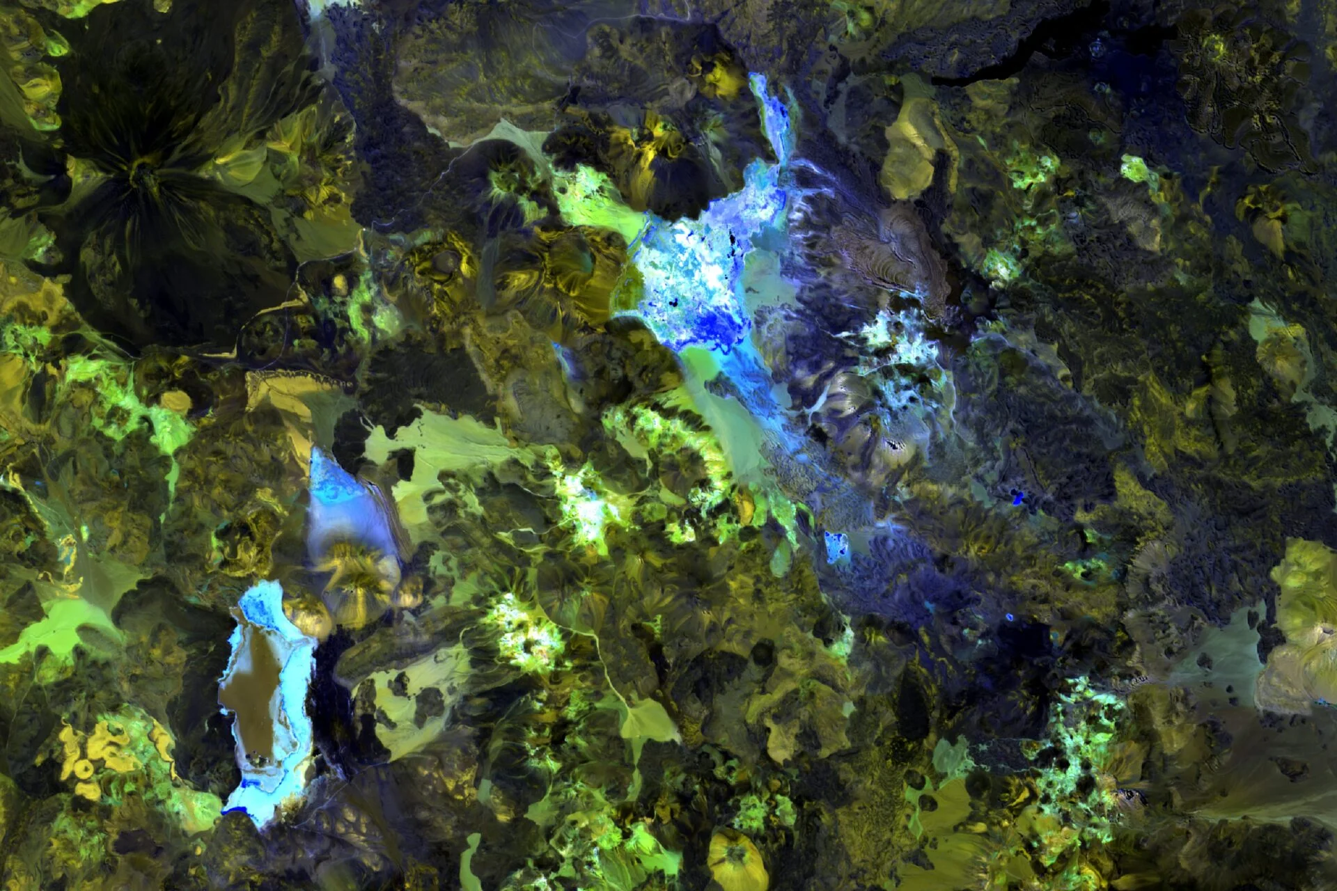
Beata Cybulska from Poland received third place for “When Earth Paints”, a satellite image of the volcanic highlands of northern Chile.
Turquoise, green, yellow and deep indigo shapes spread across the landscape, resembling an abstract painting. These are representations of real spectral information captured by Copernicus Sentinel-2. By combining selected spectral bands, the participant revealed geological and mineral structures that are less apparent in conventional natural-colour imagery.
For Beata Cybulska, a graduate in spatial management who has been fascinated by geography since her school years, this was her third participation in the CloudFerro contest.
What fascinated me most was the possibility of revealing an entirely different side of this seemingly monotonous landscape. Only the right combination of Sentinel-2 spectral bands made it possible to reveal the intense colours and unusual structures, turning the satellite image into something resembling an abstract painting.
- Beata Cybulska from Poland (3rd place)
The same satellite data can reveal beauty – and help protect lives
The contest also attracted participants whose everyday work with satellite data has a very different purpose. Konstantinos Lymperopoulos from Greece, one of the 12 winners, is a PhD candidate at Harokopio University of Athens, where his research focuses on natural hazards and risk assessment.
Konstantinos' image, “Ice and Crimson: The Surging Pulse of Malaspina Glacier”, captures the immense glacier in Alaska, with ribbons of blue ice, dark rock moraines and crimson-coloured tundra. For him, the contest offered a different way of looking at the same kind of scientific data he uses in his research. His experience illustrates the many roles Earth observation plays today.
For the past six years, my academic work has focused on natural hazards and risk assessment, where satellite imagery is primarily used to analyze disasters, vulnerability, and destruction. Participating in the ‘Seize the beauty of our Planet’ contest was deeply inspiring for me because it offered the exact opposite perspective: a chance to look beyond hazards and celebrate the sheer, creative beauty of natural processes.
- Konstantinos Lymperopoulos, PhD Candidate, Harokopio University of Athens, Greece (Finalist)
Earth observation’s growing role in public safety and the economy
Satellite data helps scientists monitor glaciers, forests, coastlines and changing ecosystems. But it is also increasingly important for public safety and economic resilience – from assessing flood damage and monitoring droughts to supporting agriculture, infrastructure management, insurance and emergency response.
During the severe floods in Central Europe in September 2024, for example, Poland activated the Copernicus Emergency Management Service to help map affected areas using satellite observations. Such information can support emergency services in understanding the scale and location of flooding.
These applications also have growing economic significance. According to the European Union Agency for the Space Programme (EUSPA), global revenues from Earth observation data and services are expected to rise from €3.5 billion in 2024 to €7.9 billion by 2034.
Artificial intelligence is accelerating the ability to extract useful information from satellite observations. At the same time, the growing volume of data creates challenges for computing infrastructure, processing efficiency and the reliability of analytical results.
When we think about the space industry, we often think about satellites. But what happens to all the data these satellites send back to Earth? It needs to be stored, processed and made available to users. European space programmes have helped researchers and companies across Europe develop expertise in precisely these areas. Some of that expertise has helped build successful businesses, with CloudFerro being one example.
Today, as AI creates new opportunities for Earth observation, access to data, computing capabilities and control over infrastructure are becoming even more important. Imagine a service that lets you ask, in natural language, how often a town has been flooded over the past ten years, without needing to know which satellite images to download or how to process them. We’re not quite there yet, but this is the direction Earth observation is heading.
- Dr Jędrzej S. Bojanowski, Director of EO Data Science and Products at CloudFerro.
For CloudFerro, which provides cloud services and manages Earth observation data for major European platforms, including the Copernicus Data Space Ecosystem and CREODIAS, these questions are part of the everyday work of making satellite information available and usable at scale.
Bringing the beauty of Earth closer to people
One of this year's 12 winning authors, Abdou Ndame Thiam from Senegal, is a third-year geomatics student at the École Supérieure Polytechnique de Diamniadio, Université Amadou Mahtar Mbow. He chose the Sine-Saloum Delta in his home country. “The Breathing Delta” shows an intricate landscape of mangrove-lined channels, salt flats and tidal waters. It is a place he describes as his country's wild heart.
I was inspired to participate because satellite images reveal a beauty we cannot see from the ground. I wanted to share this view of the Earth from space, and to show that a student from Senegal can create a beautiful satellite image. I chose the Sine-Saloum Delta, a UNESCO site, because from space it looks alive, breathing with the tides, the rivers and the mangroves. I wanted to show its beauty and its fragility to the world.
- Abdou Ndame Thiam from Senegal (Finalist)
This encapsulates a less obvious reason why the contest has attracted participants for seven consecutive years. Beyond the technical skills needed to prepare satellite images, the competition offers people an opportunity to share places they care about and draw attention to natural landscapes that many of us may never experience in person.
The contest is organised by CloudFerro, a Copernicus Ambassador, and held under the honorary patronage of the Polish Space Agency (POLSA). All 12 winning images will be featured in the CloudFerro calendar for 2027.
The images and stories of their authors are available at: https://cloudferro.com/contest2026/
SEIZE THE BEAUTY OF OUR PLANET
Meet the winners
See all the 12 finalists' images of the 7th edition of CloudFerro satellite image contest, read the stories behind them, and learn more about 'Seize the beauty of our Planet' initiative.